Travel Information Cerro Pachón - Chile
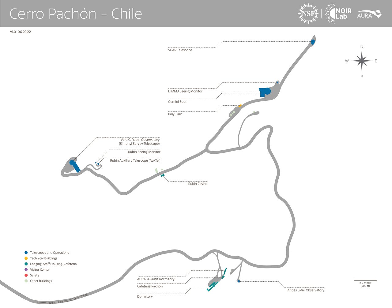
Cerro Pachón
Cerro Pachon is located 10km southeast and 0.5km higher than CTIO (Cerro Tololo Inter-American Observatory), at an altitude of 2.701m, in the Chilean Andes.
The geographical coordinates of the SOAR Telescope on Cerro Pachón are:
Geodetic latitude: -30º 14' 16.41"
Geodetic Longitude: -70º 44' 01.11"
Geodetic height: 2748 m
Elevation: 2713 m
Geocentric Latitude: -30º 04' 14.89"
The geodetic height (in m) is measured with respect to the WGS-84 ellipsoid, the elevation (H) is measured with respect to the EGM96 geoid ("mean sea level").
Cerro Pachón is about a 1h 45min drive east of the city of La Serena, where the NOIRLab Chile offices are located. The observatory can be accessed by driving on route 41 for 50 km, then making a right on the dirt road that extends for another 20km to Cerro Pachón, and also leads to the Cerro Tololo Inter-American Observatory (CTIO). However, public access is restricted by a guarded gate just a few hundred meters from the main 41 route.